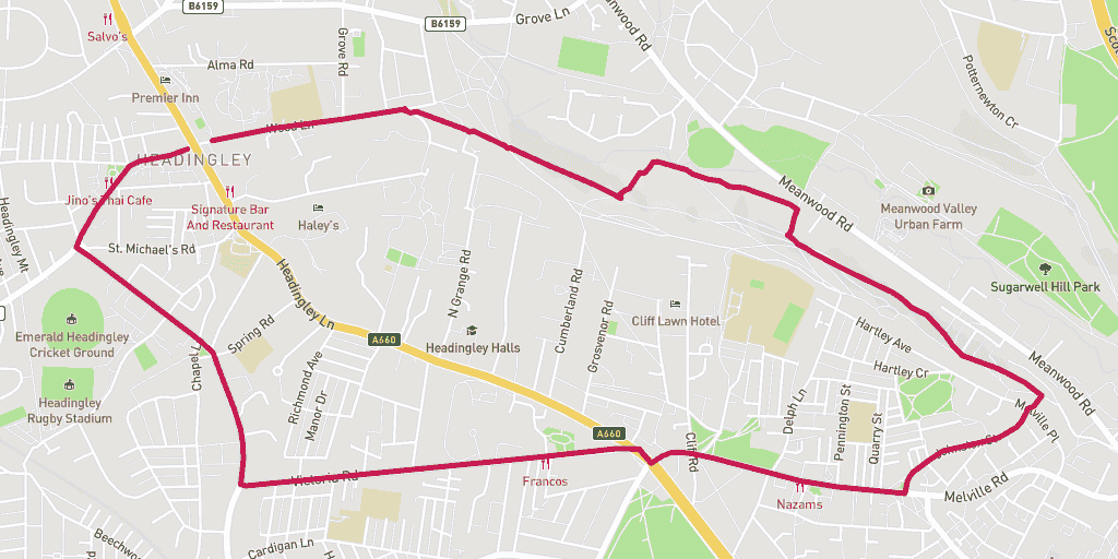
Overview
The Woodhouse Ridge 5km run route is an exciting run on road and pathways, through woodland and on streets.
The greenery of Woodhouse Ridge stands out on the run because it’s a special strip of native woodland. You will finish the run amid the buzz of Otley Road in Headingley.
Wanting to find your way to the start of the route? Here is a link for a Google Maps Directions page.
This route has a distance of 5.33km and an elevation gain of 121m.
The largest non-stop incline begins in the first third of of the route, and has a distance of 237m and an elevation gain of 21m. You can see this on the above elevation chart in red.
The largest continual decline is 88m long with an elevation drop of 25m which starts within the first kilometre of the route. This is shown on the chart as green.
Route Highlights
The highlight of the Woodhouse Ridge 5km is the way the run brings you closer to nature. The contrast of Otley Road makes running through this little piece of paradise a delight!
Best Time To Run
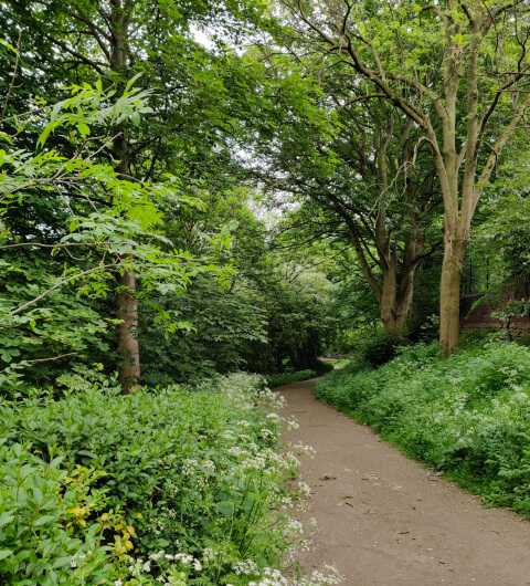
Without a doubt the best time to run the Woodhouse Ridge 5km is during the months of spring. You might appreciate the stunning colour of the bluebells and the distinctive smell of wild garlic. At the bottom of the ridge keep an eye out for the wild orchard.
Route Description
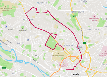
Start running along Wood Lane away from Otley Road. At the end turn right onto the pathway traversing the top of the Ridge. Continue on dropping down into the middle, then bottom sections of the wood. The steps make for an ideal workout bolt on to your run.
At the bottom of the ridge run back up the hill and exit the green space onto Johnston Street. Stay on this street until you meet the hill on Melville; continuing on all the way to Hyde Park corner.
Once at Hyde Park Corner cross diagonally onto the flat straight of Victoria Road. Turn right at the end and get ready to slog it up Cardigan Road. When you reach the traffic lights turn right onto North Lane and finish the final section of the run back onto Otley Road.
Warnings
The two things to watch out for couldn’t be poles apart. Otley Road is one of the busiest roads in and out of Leeds – take care when crossing!
Once on the ridge your biggest risk is the uneven footing on the paths. The biggest culprits for falls and sprains are the spindly roots and sharp rocks.
Location
Woodhouse Ridge runs between Ridge Road in Woodhouse and Grove Lane in Headingley. Before it reclaimed its state as a native wood the Victorians made it a space for relaxation. A key part being the impressive views over the landscape of Meanwood and beyond – check this when running atop the ridge.
If you like running in this area, why not take a look at some other routes in similar areas. This route went through: Headingley.
Amenities
Otley Road marks the start and finish of the Woodhouse Ridge 5km. All along this bustling road there is a selection of bars, restaurants and cafes.
The closest toilet to Woodhouse Ridge is at the Barn Coffee Shop just off Meanwood Road.
Parking
Park for free on the residential street of Wood Lane, postcode: LS6 2PF (Google Map Directions) – the run begins at the start of this road.
Food and Drink
A great halfway point for a break is the Barn Coffee Shop at Meanwood Valley Farm. Grab a quality cup of fresh coffee and a carby snack from this pleasant café.
The end of the run on Otley Road offers a wide range of eateries. One guaranteed good feed is the Greek and Turkish cuisine of Santorini Bar & Grill.
